Live Track - Past 90 daysDistance Sailed to date - 15,383Nm
Download Email Maximum of 160 characters and you cannot include images, as this is a Short Message Service only. Download
Download our track Email us OffShore SMS us OffShore Download GoEast tracks

Wednesday, April 17, 2019

Consigned To Spares

We’ve been scrutinizing our anchor chain when deploying the anchor of late. Is the chain stretched and twisted? The bow rollers certainly look a bit worn. It’s a bit of a chicken/egg conundrum. What is causing what? Replacing the rollers might provide some answers, however you can’t just buy them.


We trawled through old photos. What did the bow roller originally look like? What kind of profile did they have to begin with? In any instance 97mm width replacements were nowhere to be found. They’d need to be machined for us. 

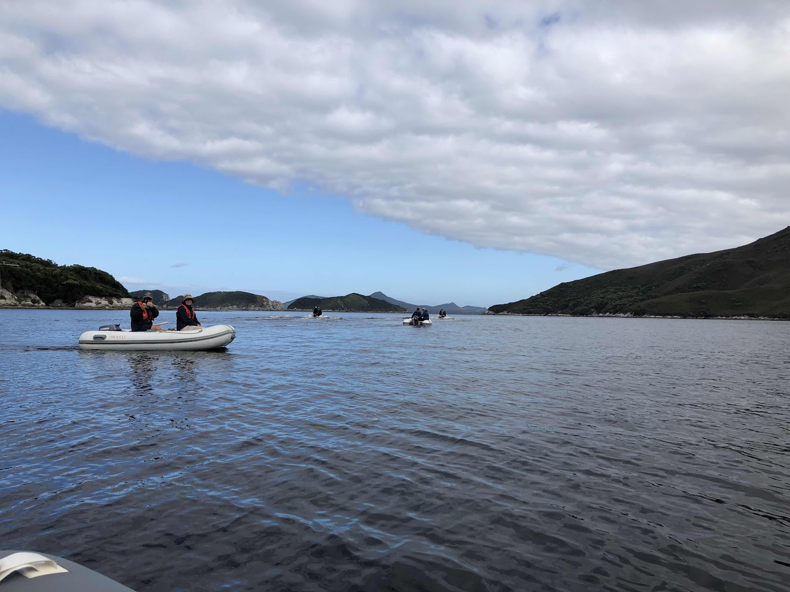
Bermagui proved an opportunity too good to miss. We would be tied up to the Fishing Co-op Wharf for 4-5 nights meaning we would not be dependent on our anchor. There's a reasonably big fishing fleet based in Bermagui and a boat yard to support it. There was a fair chance we’d be able to get a new replacement pair of bow rollers machined.

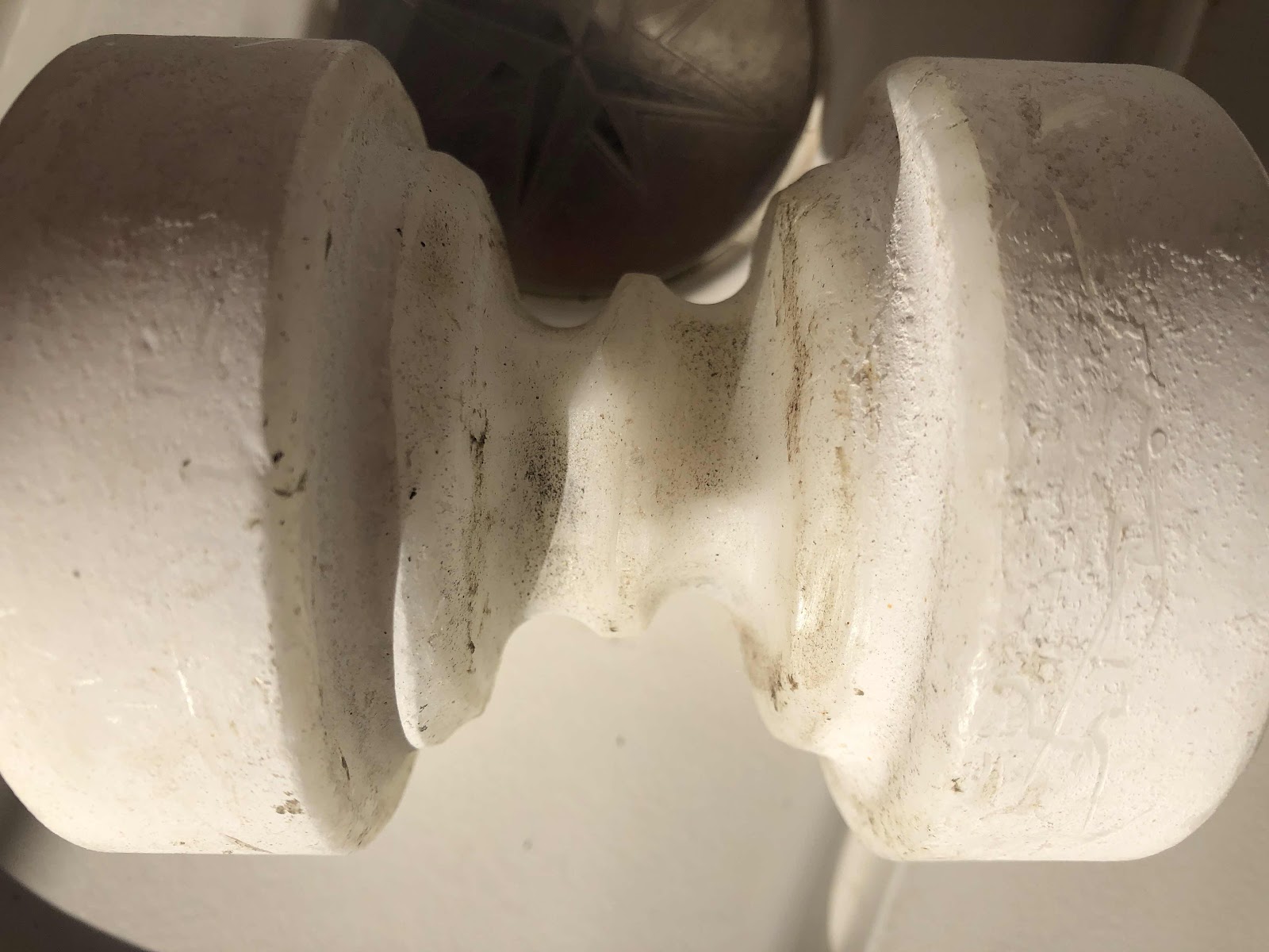
Wear was very evident on both rollers and it was quite square on one of them. No wonder the chain was bouncing under the anchor locker lid.


The Bloke walked across to the boat yard each day to check on progress and luckily they were able to manufacture the replacements. They are not white but apparently made of a much stronger material. Fingers are crossed that twisted anchor chain is a thing of the past. If not, our problem could be associated with stretched links. This would point to the need to replace the anchor chain. In truth it's probably a bit of both. Fingers are crossed for improvement and the original rollers have been consigned to ‘spares’.


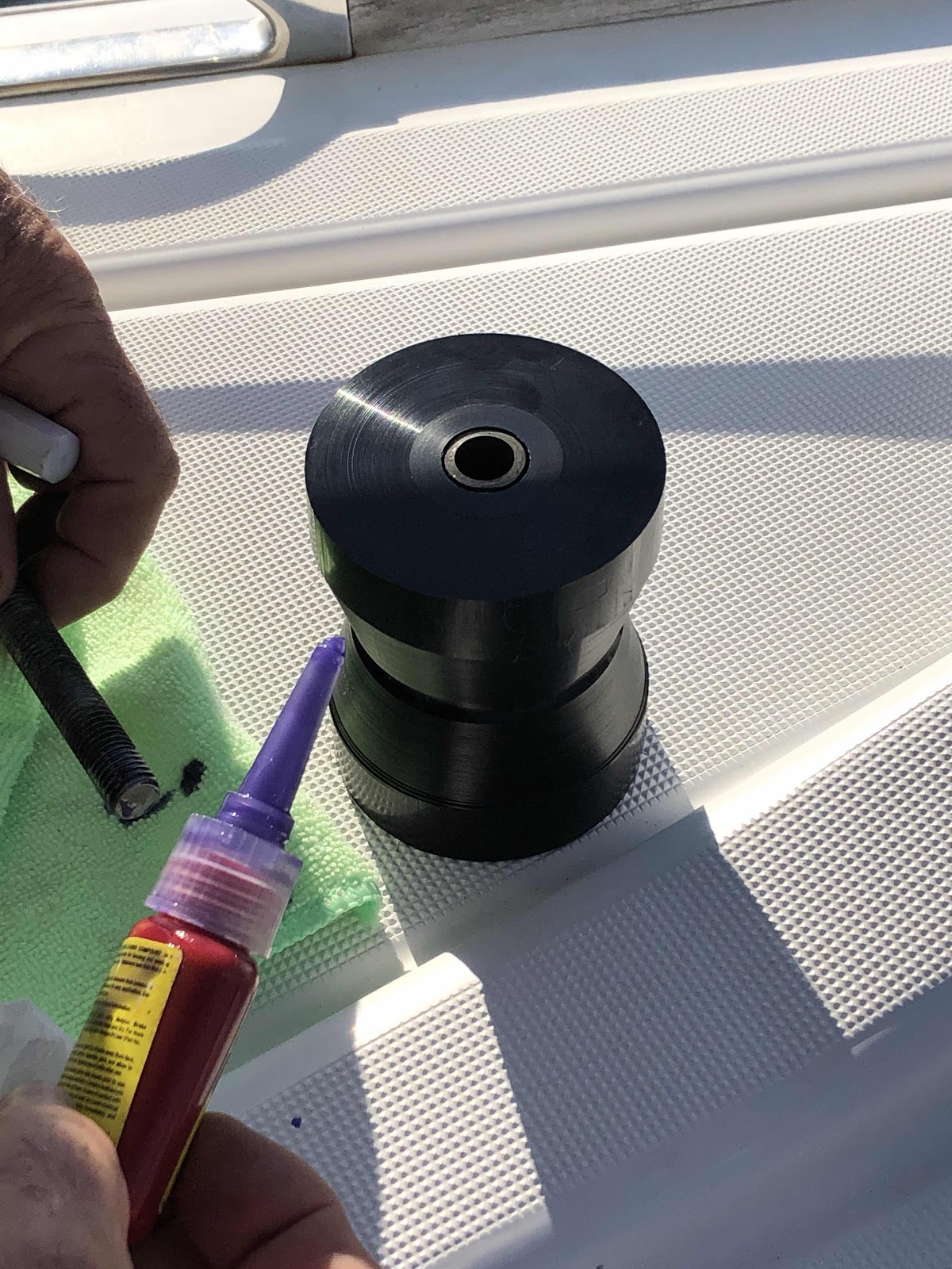
Post script: The groove in the new roller was not deep enough so we had it re-machined in Bundaberg. The workshop asked for a sample of our 10mm short link chain to better model the guide channels. We are now delighted with the outcome. The chain deploys with less twists. The Blokes enthusiasm caused 3 more boats to get their rollers re/done too! 

Tuesday, March 19, 2019

Friday Fish and Chips and a Day in Dunnalley

“How lucky?” is was what The Bloke was thinking. Our early transit time through the Dunalley Canal would enable us to anchor/moore/come-alongside in good time for a walk to have a Fish and Chip lunch. It was Friday after all! There was rumour too that there was a bakery. Could the fish and chips be bested by a sausage roll perhaps? In any instance, we needed an in-going high tide, especially since we had Chris on Bilbungara trailing us in a deeper drafted vessel than ours; if we got stuck he would know he was in trouble too!


Shane, the canal operator, was ready for us and we’d actually traversed the shallowest part - the channel approach in, before reaching the bridge and the Canal itself.

Bilbungara followed us through. This perspective makes it appear that the Canal is a serious affair but it's actually a bit 'agricultural' and more like a trench created by a farmer with a backhoe.


This old manual signal tower, gives an indication of how long the Canal has been in existence. It was opened for use in 1905. These days traffic is managed by significantly less athletic means via VHF radio and mobile phone.

 
Once we got through we opted to raft-up to the public jetty to make access to the bakery and fish and chip lunch a little easier. Conditions were mild. A northerly kicked in overnight and made for a very unpleasant night. The Bloke and Chris were sipping coffee at 3am while I snored my head off.


Ignore The Bloke in this photo, he does not actually know what he's pointing at! It's a tricentennial memorial to the discovery of Van Diemen's Land by Abel Tasman in 1642. Blackman Bay, to be honest, is quite a strange place to arrive, but Tasmania was not known to even be an Island until about 150 years later. Forget all that Captain Cook stuff, Tasmania was a going concern long before 'Botany Bay' and all that malarkey!

The Dunnalley Pub has a bit of a 'folly' decorating a drainage dam adjacent to their car park.

 
The Dunnalley Pub.

The tide can rip through at up to 17kts, according to the Canal Manager, Shane.

  
It's a funny place allright!

Not where The Bloke got his Friday Fish and Chips but another worthy place to visit.

Tuesday, February 26, 2019

Port Davey Heathland Flowers

The soil around Port Davey, Bathurst Harbour and Mallaleuca is very impoverished and such that it is, is composed of degraded quartzite rock mixed with meagre humus created from those few hardy plants that have managed a toehold in this windswept and inhospitable environment. Clefts between hills have some shrubs and even some trees but for the rest, button grass is the ‘feature’ vegetation. Areas closer and lower to the water are constantly being leached and contribute to the tannins in the water. The waterways are the colour of tea and being freshwater do not mix with seawater. The seabed is shaded by the tannin-load of the surface freshwater layer and sea life reportedly includes organisms normally found in deep ocean.


I took a lot of photos of plants while climbing Mt Beatie and found they didn’t vary much throughout the area. In fact, Mt Beatie had the best range and display of any part we explored in the SW Wilderness.

Everything was small, woody and without extravagance.


Hillclimbing Mount Beatie - Day 3 Port Davey Visit

Having completed our inspection of Breaksea Islands early in the morning, we were left with plenty of time to do our first shore expedition and climb Mt Beatie. Our efforts were to be rewarded with some spectacular views both over Port Davey and down the Bathurst Channel.

Only our dinghy was not in this shot. The Bloke had other ideas about where to come ashore.
 
Our dinghy, all alone.
 
Tannin stained water.

Looking South West beyond Breaksea Islands

Breaksea Islands


Up top

View to the Mauvereens.

We could see the clouds that heralded a wind change, so after climbing down we headed off to Anchorage #3 in as many days - Spain Bay. 

Breaksea Islands - Day 3 Port Davey Visit

Another early start for our dinghy convoy was rewarded by some exploration of the sheltered side of Breaksea Islands. It’s not until you get up close that you can really appreciate that it’s not a single island although it may have begun as one. It’s aptly named since westerly conditions would no doubt cause the seaward side a huge pounding. It’s like a natural attenuator wall. From the seaward side in Port Davey, it completely obscures the entrance into the Bathurst Channel.


Our little convoy using the best of the calm conditions.

  
A yacht is visible sailing around in Port Davey.

 
Swell can sneak in though gaps like this one.

Waves and wind have combined to create this arch

Bull kelp at the waterline

A gulch
We were informed that some of these gaps and caves are 50m deep and come out on the other side but satisfied with simply being told of this and not in the least keen to verify the fact.

  
There is some courageous vegetation on the lee side, but not much.